• English
  • العربية
  • 中文
  • Français
  • Русский
  • Español

You are here

Developing Soil Conservation Strategies Protecting Chilean Forest Highlands From Erosion

,
Chile Soil management

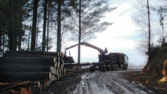
The forestry sector has become a driving force in Chile’s national economy, with exports increasing from approximately US $4 million in 1970 to US $5.9 billion in 2011. However, the intensification of commercial forest and agricultural production in southcentral Chile has increased soil erosion and associated water pollution due to sediment delivery from the vast disturbances caused by forest harvesting and replanting activities. A programme supported by the Joint FAO/IAEA Division and the Government of Chile, is using fallout radionuclides (FRNs) and compound specific stable isotope techniques to trace the sources of sediments, in an effort to further develop soil conservation strategies.

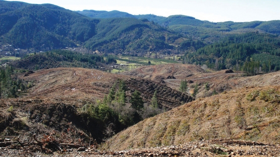
In the commercial forest areas of south-central Chile up to 3.9 tonnes of soil per hectare are lost to erosion each year after tree harvests. This is 78 times higher than erosion losses of undisturbed closed forests, which lose only 0.05 tonnes per hectare per year. This erosion poses a major threat to Chilean soil conservation and impacts government efforts to further intensify the forestry sector, which, in 2013, accounted for 7.4 per cent of the country’s total exports. With the increasing occurrence of extreme and erratic weather events due to climate change, combined with the area’s long and steep slopes, erosion may even be as high as 100 to 120 tonnes per hectare per year.

Sediment sources identified and quantified

With the support of the Joint FAO/IAEA Division, the research foundation Fondo Nacional de Desarrollo Científico y Tecnológico (FONDECYT), the Government of Chile and the Universidad Austral de Chile initiated a project aimed at investigating the impact of forest harvesting on fine sediment yield. This called for measuring the contribution of the main sediment sources – catchment surface, forest roads and stream channels – in forested catchments in south-central Chile during and after tree harvesting operations.

The catchments chosen and paired for study – Nacimiento and Los Ulmos – are located about 400 kilometres apart. They have similar soil types, but greatly differing mean annual rainfalls of 1 200 and 2 500 mm per year, respectively.

The project found that, prior to harvest operations, sediment sources are predominantly roads and streams. After the harvest, however, there is a marked movement of surface material from forest slopes caused by soil disturbances during the harvesting process. Using sediment source fingerprinting, the relative contributions of the different sources in the study catchments to the sediment yields are currently being quantified to establish appropriate countermeasures.

Radionuclides such as caesium-137, lead-210, beryllium-7, potassium-40 and radium-226, as well as the organic carbon and total nitrogen content of soils and sediments, are used as fingerprints to identify key sources of fine sediment that reach the water bodies and to quantify the relative contribution of each source to the total sediment yield. The ability to trace the sources of these sediments, and hence to identify hotspots of land degradation, are essential in efforts to develop and optimize appropriate and cost-effective soil conservation strategies at the landscape level.

Knowledge of sediment sources improves management planning

The ability of the fingerprinting technique using fallout radionuclides to trace sources of these sediments and to identify hotspots of land degradation, is essential to efforts to develop and optimize appropriate and costeffective soil conservation strategies at the landscape level.

Looking to the future, applying the information about degradation of hotspots and sources of fine sediments identified by the project promises a reduction in the negative impact of commercial forestry operations on water quality. The information also supports improved and data-based decision-making processes for implementing enhanced and cost-effective sediment management practices. This will improve the factual basis of Chile’s policy on Sustainable Forest Management Certification. In addition, an increased understanding of sediment sources and their relative contributions to fine sediment yields from forested catchments in southcentral Chile, particularly during critical periods of disturbance by harvesting operations, will be applicable to other regions and landscapes with sediment-related environmental problems.

Related resources

Stay in touch

Newsletter