You are here

Climate Change's Effects on Mountain Regions: Insights from FAO/IAEA Scientific Expeditions to the Andes

,

Edson Ramirez measuring morphometric changes in water rivers in basins with glacier coverage in Nevado Illampu, Cordillera Real (Bolivia). (Photo: Abraham Machaca)

Since the 1950s, almost all of the world’s glaciers have been retreating, according to the latest report by the Intergovernmental Panel on Climate Change. This is unprecedented in at least the last 2 000 years, scientists say, and is very likely caused by human activities contributing to climate change.

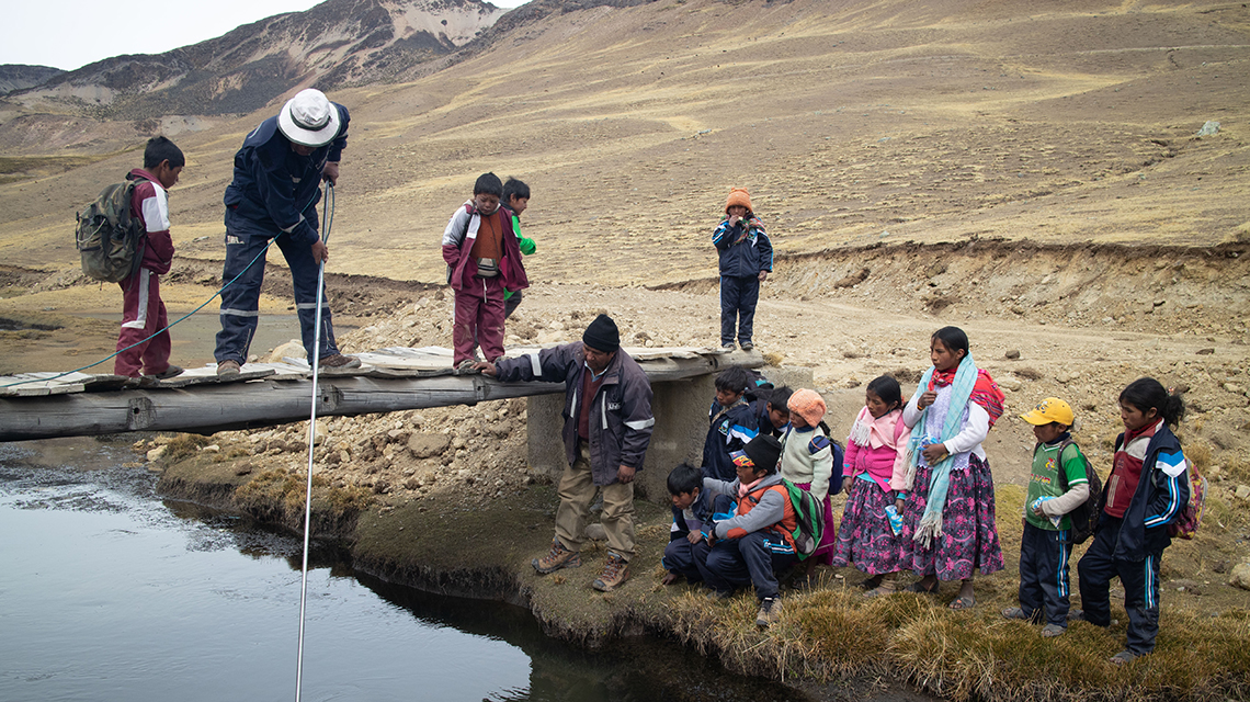
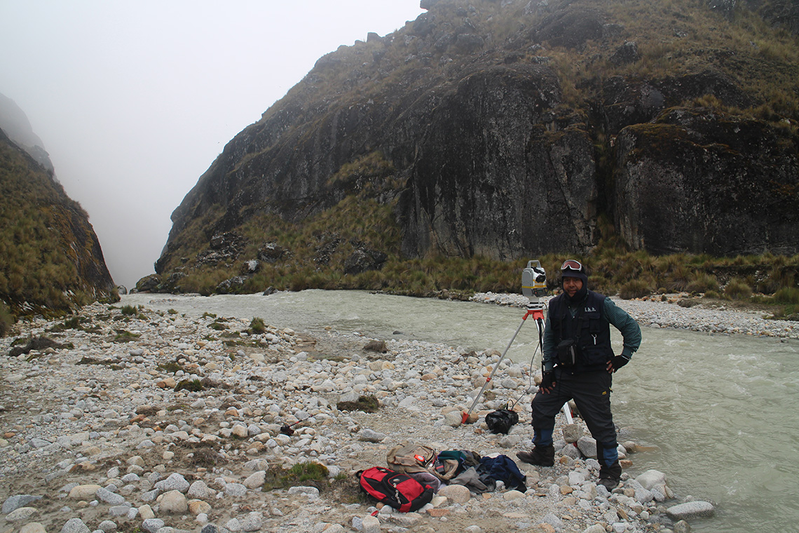
Since 2014, the IAEA – in cooperation with the Food and Agriculture Organization of the United Nations (FAO) – has supported 50 scientists from 12 countries to use nuclear and isotopic techniques to survey mountain ranges of up to 6 000 m altitude on six continents and assess the impact of climate change on soil and water resources. Thanks to an international network of laboratories created to analyse and share the results of these surveys, decisions makers have access to timely, accurate information to help them develop tailored climate-change adaptation and mitigation strategies.

To find out more, we spoke to Edson Ramirez, a glaciologist at the San Andrés University in Bolivia and the coordinator of the FAO/IAEA’s studies in the Andes. Here are his insights into what the studies have revelated about the status of this range of mountains spanning seven countries and home to 85 million people:

How has climate change been impacting the Andes?

The state of glaciers in the Andes was assessed in December 2019 by glaciologists from the UNESCO Snow and Ice Working Group of the International Hydrological Programme for Latin America and the Caribbean, through the Declaration on Glaciers and Climate Change (Portillo-Juncal, Chile). They expressed their concern about the evidence of strong glacial retreat, thinning and even extinction of glaciers in the region. The retreat of glaciers has become noticeable, with particular intensity in the last four decades, due to climate change. On average, the glaciers in the Andean region – Bolivia, Colombia, Ecuador and Peru – have lost over 50 per cent of their coverage since the 1960s. And in the last decade, the rates of retreat and loss of ice thickness have further increased, notably in the arid and semi-arid Andes of Argentina and Chile.

The IAEA project has led to a better understanding of the impact of climate change on the cryosphere (glaciers, permafrost and snow) and its effects on soil and water resources. Why is such an assessment important?

This assessment enables us to find out whether the impacts of climate change in high mountain ecosystems, such as glaciers, wetlands and others may affect the availability of water resources. In the Andes region, mountain water resources are used for human consumption, hydropower generation and irrigation. Therefore, water availability is key to food security and energy production. Practically half of the regional electricity comes from the hydroelectric potential of the Andean rivers. Hydroelectric power supplies about 70-80 per cent of electricity needs in Colombia, 50 per cent in Peru, and 45 and 40 per cent in Ecuador and Bolivia, respectively.

Flow measurements in high altitude wetlands in Apolobamba, Bolivia, 2016. (Photo:  Edson Ramirez)

What are the key findings of the surveys, so far?

In Chile, Bolivia and Peru, scientists have helped to better understand the impact of climate change on land and water resources in the high Andes. Through three major field campaigns in the three countries, with participation of local and international scientists, more than 800 soil, sediment and ice samples were collected.

Nuclear techniques helped trace the origins and pathways of sediments and calculate the sedimentation rate of lakes, reservoirs and wetlands. New sediments become exposed after the ice of the glacier retreats. When these are transported by rainwater, they can invade waterways and pollute rivers and fish with heavy metals. They can also settle in and dry out wetlands, which may then become less suitable for capturing and buffering water, and at the same time they can become a source of greenhouse gas emissions. Downstream, when the ice melts, at first the water availability increases. The water then reduces as the stock of ice available decreases, reducing the amount of water discharged into the river. Reduced water quality and availability impact local populations, crop production, livestock and tourism.

Studies carried out by Brazilian scientists linked to the project have also made it possible to better understand the impact of Amazonian forest fires on the melting of glaciers in the Andes. As smoke plumes from forest fires reach the glacier, they darken its surface causing it to then absorb more of the sun's energy, and therefore amplify the melting. Modelling combined with in situ measurements showed that this phenomenon may contribute to approximately five per cent of the surface melting of the Zongo glacier in Bolivia.

Further, the surveys in field and laboratory using isotope techniques helped to identify types of soils, land use and cover being most critical for emitting greenhouse gases when temperature further increases.

How are nuclear and isotopic techniques used and what makes them unique in assessing the impact of climate change in mountainous regions?

Conventional techniques and methods, such as sediment redistribution measurement, are no longer sufficient to assess, at a fine level of detail, the impacts of climate change on soil and water resources in mountainous regions. Thus, the application of isotopic and nuclear techniques – highly reliable and precise tools – open a new window of possibilities to decipher subtle changes in the ecosystems we are studying.

Nuclear techniques based on the measurement of carbon-13, carbon-14 and nitrogen-15 isotopes were used to determine the age of soil’s organic carbon content and its stability. When organic carbon is not stable, the soil can release CO2 more easily. Various experiments were conducted in laboratories, using soil samples from the different study sites with varying climates, land use and soils. By changing temperature and soil moisture regimes in the laboratory, the scientists aimed to find out how changing climate conditions would lead to an increase in greenhouse gas emissions and as well as whether the old or just young carbon would be a source for greenhouse gases.

Climate change also has an impact on sediment distribution. Scientists measured sedimentation rates in natural and artificial water bodies, to find out how large the impact of climate change, such as retreating of glaciers, was on this process. Nuclear techniques included various radionuclides present in the soil and sediments, which are used to assess soil degradation and sediment redistribution in different time scales.

Nuclear techniques were also used – along with conventional techniques – to date sediments and understand past and current changes in climate and the landscape. Understanding the past allows to better predict future trends.

How can the kind of information gathered on the expeditions support the development of climate change adaptation strategies for ecosystems and local populations?

We expect to offer new, accurate science-based evidence for decision makers to establish tailor-made regional policies for climate change adaptation and mitigation. The United Nations Environment Programme and FAO support the science–policy dialogue resulting from the findings. Decision makers are involved and local populations also expressed clear support to our work, which is encouraging for us.

Our data are useful for developing water resource management plans and managing watersheds. For example, controlling erosion in hydrographic basins – the areas of streams where precipitation drains off into rivers or other bodies of water – will reduce the production of sediments that can compromise the storage capacity of reservoirs supplying water for human consumption and hydropower production.

Also, comparing “signatures” between the current and the accumulated sediment in proglacial lakes, which are freshwater lakes formed behind ice dams or the soil and rock material left behind by a moving glacier, offers a perspective over time of the changes that have occurred during the glacial retreat stages. This helps in developing possible future scenarios, for which watershed management plans can be established.

David Choquehuanca, the Vice-President of Bolivia, and Bernardo Gurarachi, the first Bolivian to reach the top of Mount Everest, both expressed their full support for our project, as it responds to the need to generate scientific evidence on the impacts of climate change on water resources. The results obtained will be used by government institutions such as the Ministry of the Environment and Water and the Authority of Mother Earth in Bolivia to develop policies for adaptation to climate change.

A child from Tuni village helping the preparation of samples for analysis during an expert mission in Bolivia, (May 2017). (Photo: Edson Ramirez.)

How can scientists globally use the results of this work and what are the next steps?

A sharing platform on the IAEA’s Cyber Learning Platform for Network Education and Training makes data available to experts for evidence-based decision making. It enables researchers and laboratories from different countries to have organized and systematized data to carry out their studies on a global scale.

The current FAO/IAEA project running until 2023 involves more regional participants from research institutes and universities, more decision makers and more members of the local population.

We expect now to gain a better understanding of the role played by high altitude wetlands as regulators of water flow, thanks to the use of Cosmic Ray Neutron Sensors, a new technology that can measure the moisture content of the soil in a wide area continuously. We will also strengthen and extend the interregional network of laboratories and competent institutions for the evaluation and prediction of climate change impacts.

Stay in touch

Newsletter